Naogaon Fm
Type Locality and Naming
Type section is in the Naogaon Village along Disang River. [Original Publication: Mallet, F. R., 1876. On the coal fields of Naga Hills bordering the Lakhimpur and Sibsagar districts. Mem. Geol. Surv. India, (1292), pp. 14-94.]. Reference well: Makum coal field area. Its thickness is about 1100 m.
Synonyms: Revised by Evans (1932) and Deshpande et al., (1993). Originally, the sandstones conformably overlying Disang Shales were placed into Naogaon Sandstone stage (Mallet, 1876). However, later Evans (1932) grouped these sandstones as lower part of Barail Series to constitute his Nagaon Sandstone "stage". Subsequently, the term Naogaon was extended to the arenaceous Barail Strata overlying Kopili Fm in the subsurface of Upper Assam oil fields region by Bhandari et al., (1973) and Pandey (1982).
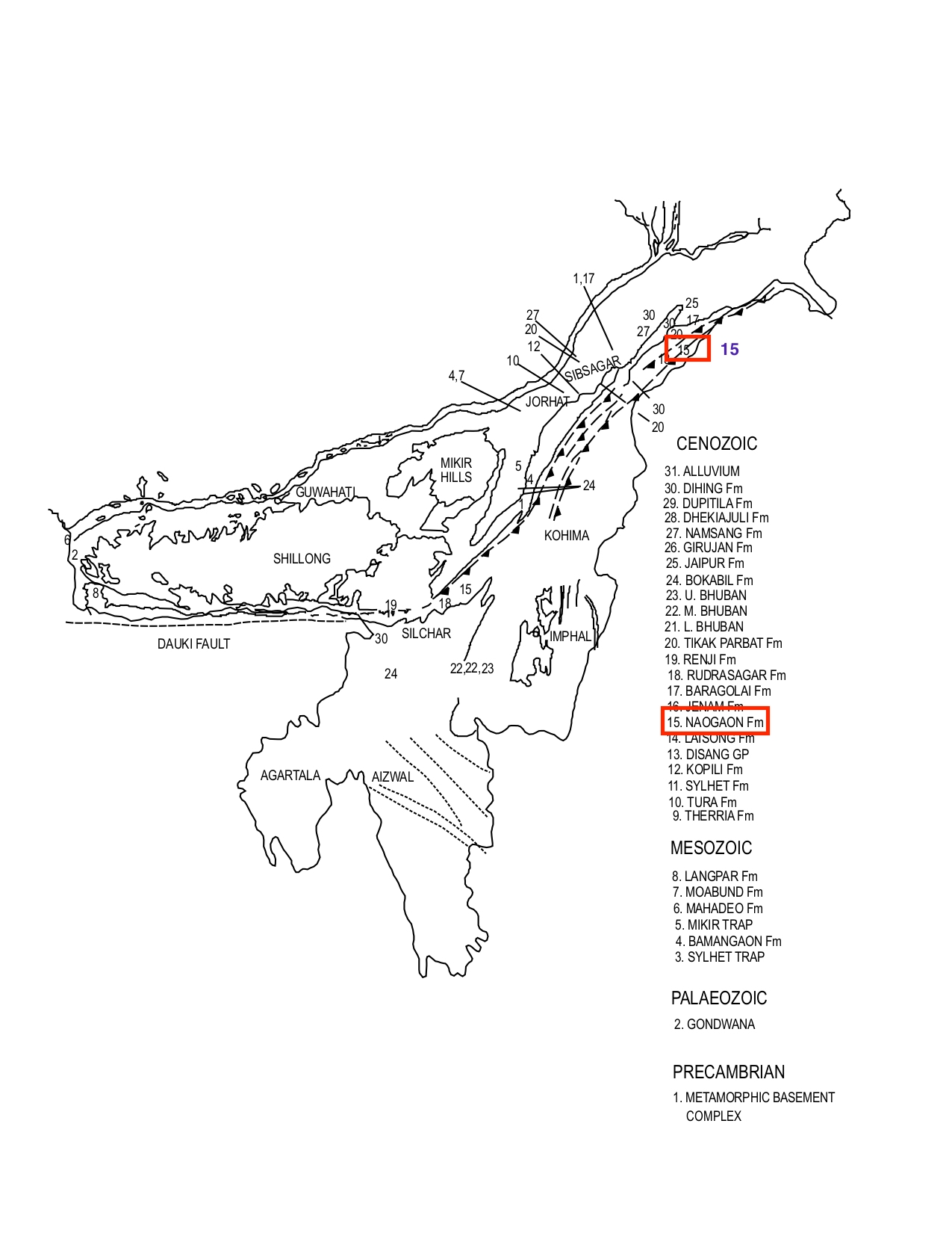
[Figure 1: Formation stratotypes of North East Basins (modified after Pandey and Dave, 1998)
Lithology and Thickness
Sandstone. Type section lithology: Along Disang river, an incomplete section is exposed owing to the faulting. This incomplete section along Disang River measures about thickness of 650 m. In the lower part an alternating sequence of thinly bedded sandstones and shale is present. This sequence is overlain by a sandstone sequence; the sandstones are grey, fine-grained, massive or thinly bedded and hard. Reference section lithology: In the Makum coalfield area, the Naogaon Formation in the lower part consists of alternating sequence of thinly bedded sandstones, shales, and sandy shales. The sandstones are occasionally massive. This sequence gives way upwards to massive or thin-bedded sandstones with intercalations of shale and carbonaceous shale.
In the subsurface of Upper Assam, these two outcropping divisions constitute distinct members - a lower Disangmukh and an upper Demulgaon member.
Relationships and Distribution
Lower contact
It conformably overlies Disang Gr.
Upper contact
Conformably overlain by Baragolai Fm.
Regional extent
Naga Schuppen Belt: It is exposed only in the northeastern part of Schuppen Belt and subsurface of Upper Assam. No drastic lithological variation is observed in Nagaon Formation.
GeoJSON
Fossils
No fauna is reported from this formation.
Age
Depositional setting
Deltaic environment
Additional Information
